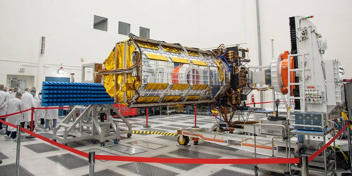
NASA and ISRO are gearing up to launch one of the most advanced Earth observation missions ever created—the NISAR (NASA-ISRO Synthetic Aperture Radar) satellite. Designed to provide three-dimensional, high-resolution data of the planet’s land and ice surfaces, this first-of-its-kind collaborative satellite will play a pivotal role in tracking disasters, monitoring land movements, and understanding the effects of climate change. The launch is expected to take place no earlier than late July 2025 from the Satish Dhawan Space Centre in Sriharikota, India.

Key Highlights
NASA-ISRO’s joint satellite mission targets launch in late July 2025.
NISAR will provide 3D mapping of Earth’s land and ice surfaces.
Dual-band radar will detect movements as small as 1 cm.
Mission critical for disaster management and climate science.
NASA’s Jet Propulsion Laboratory to host a mission briefing on July 21.
Mission Overview
NISAR is a product of international collaboration, blending technological strengths from both the United States and India. NASA’s Jet Propulsion Laboratory (JPL) is responsible for the L-band radar and key onboard electronics, while ISRO has developed the S-band radar, the spacecraft bus, and is handling the launch logistics. The satellite will orbit Earth and use synthetic aperture radar (SAR) to scan nearly the entire globe’s land and ice surface twice every 12 days, offering scientists an unprecedented view of Earth’s dynamics.
Advanced Radar Technology
NISAR employs dual-frequency radar: the L-band radar (with a wavelength of about 25 cm) is capable of penetrating vegetation and soil, making it ideal for tracking subsurface changes. Meanwhile, the S-band radar (around 10 cm wavelength) offers high sensitivity to surface variations. This unique combination allows scientists to analyze different aspects of terrain deformation, moisture levels, land subsidence, and tectonic activity.
The satellite’s radar is so precise that it can detect surface shifts as small as one centimeter. This level of accuracy is vital for tracking natural disasters such as earthquakes, landslides, and volcanic activity, as well as for managing water resources and monitoring deforestation and glacier movements.
Applications and Impact
NISAR’s versatile data will support a broad range of applications:
Disaster Management: Quickly assess ground deformation after earthquakes or volcanic eruptions.
Climate Change Research: Track melting glaciers, rising sea levels, and land subsidence.
Agriculture and Forestry: Monitor soil moisture and forest biomass.
Urban Planning and Infrastructure: Help in planning resilient infrastructure by studying land shifts.
Because radar imaging is unaffected by weather or daylight, NISAR will offer continuous, reliable data even in cloudy or stormy conditions.
Conclusion
The NISAR satellite marks a significant milestone in international scientific collaboration and space technology. Its launch and subsequent operations promise to provide humanity with a powerful tool to better understand Earth’s ever-changing surface. As global challenges like climate change and disaster management become more urgent, NISAR will serve as a vital resource in addressing them through data-driven solutions. The world will be watching as this historic mission takes flight later this July.
Follow Before You Take on:
Latest Technology News | Updates | Latest Electric Vehicle News | Updates | Electronics News | Mobile News | Updates | Software Updates
📌 Facebook | 🐦 Twitter | 📢 WhatsApp Channel | 📸 Instagram | 📩 Telegram | 💬 Threads | 💼 LinkedIn | 🎥 YouTube
🔔 Stay informed, Stay Connected!